Geology
Krka Waterfalls: All Seven Travertine Falls and How They Formed
The Krka waterfalls are seven barriers of tufa, the porous limestone also called travertine, strung along the Krka River in Croatia’s Šibenik-Knin County. From the top of the river down they are Bilušića buk, Brljan, Manojlovac, Rošnjak, Miljacka slap, Roški slap and Skradinski buk. The park describes the Krka as a river about 72.5 km long with a total drop of 224 m, and calls the tufa falls its defining phenomenon. The tallest is Manojlovac, at 59.6 m. The longest and best known is Skradinski buk, the last barrier before the sea, where the water runs over seventeen steps spread along 800 m.
Most visitors see two of the seven. Skradinski buk has the park’s main walking trail; Roški slap, further upstream, is reached by road or by park boat. The other five lie in the upper canyon between Knin and Roški slap, and are seen from viewpoints, from short trails, or not at all. Below: how the falls were built, what each is like, why they change through the year, and which you can reach.
The seven waterfalls at a glance
The park measures each fall by its distance from the river’s source, at the foot of the Dinara mountain, 3.5 km north-east of Knin. Heights are the park’s own figures.
| Waterfall | From the source | Height | Can you see it? |
|---|---|---|---|
| Bilušića buk | 16 km | 22.4 m | Short trail with a viewpoint |
| Brljan | 19 km | 15.5 m | Roadside viewpoint; dry in the warm months |
| Manojlovac | 19.5 km | 59.6 m | Viewpoint and short trail |
| Rošnjak | 20.5 km | 8.4 m | Only from a distance |
| Miljacka slap | 21.5 km | 23.8 m | Not suitable for visits |
| Roški slap | 35.5 km | 25.5 m | Trail, watermills, road and boat |
| Skradinski buk | 49 km | 45.7 m in total | The main walking trail |
Five of the seven are bunched into a few kilometres of the upper canyon; the last two are spread out downstream, with long lake-like stretches between them. Fame does not follow height: Manojlovac is the tallest by far, but it is Skradinski buk, lower and much longer, that appears on the posters.
What tufa is
The park defines tufa as calcium carbonate that forms in rivers when minerals in the water settle onto surfaces. Karst country suits it: rain and groundwater dissolve the limestone, so the Krka carries plenty of dissolved calcium bicarbonate. Where the water is disturbed, on rapids and flooded branches, the splashing releases carbon dioxide, the chemical balance tips, and calcite comes out of solution as tiny crystals on whatever lies under the surface.
The park lists the conditions tufa needs:
- Hard water: supersaturated with calcium carbonate, with a carbonate hardness over 3 HD.
- Clean water: less than 10 mg/L of organic carbon.
- Alkaline water: a pH greater than 8.
- Warmth and movement: higher temperatures, and a flow of 0.5 to 3.5 m/s, speed it up.
The living builders
Crystals alone would be washed away. Bacteria colonise submerged surfaces first, algae follow, and the park explains that deposition begins on mosses, where calcite microcrystals stick to the secretions of cyanobacteria and diatom algae. Grains of limestone and shell fragments cling to them and become nuclei for more calcite. Mosses such as Cinclidotus aquaticus and Palustriella commutata do much of this work on the Krka.
The shapes depend on where the water goes. Sills and barriers form at the base of rapids, curtains and consoles where water pours down a vertical face, and ridges, grooves and pipes where a large volume cascades. Every Krka waterfall mixes these forms, which is why no two look alike.
Young falls in an old canyon
The canyon is far older than its waterfalls. The park’s geology pages say the river cut it in a single phase, which is why the walls show no river terraces, during the cold Würm stage between 40,000 and 170,000 years ago, when the sea stood much lower. The old course can still be traced as far as the island of Zlarin, off Šibenik.
When the ice melted, the sea came back. About 18,000 years ago, the park says, sea level rose by 120 to 125 m, drowning the lower canyon. Today the Krka estuary begins below Skradinski buk and runs a little over 22 km south to the fortress of St Nicholas; the park counts 49 km of freshwater river above it.
The tufa came last. Its formation began in the Pleistocene, and fossil tufa from that time sits up to 20 m above the present riverbed. Most of the tufa on today’s falls is younger than 10,000 years. As the climate warmed after the last glaciation, Skradinski buk, Roški slap and the other falls began to rise, damming the river and creating Visovac Lake. In the park’s words the waterfalls are the youngest landforms in the canyon, and they are still growing: new tufa forms all along the river, building the falls of the future.
Skradinski buk: the longest barrier
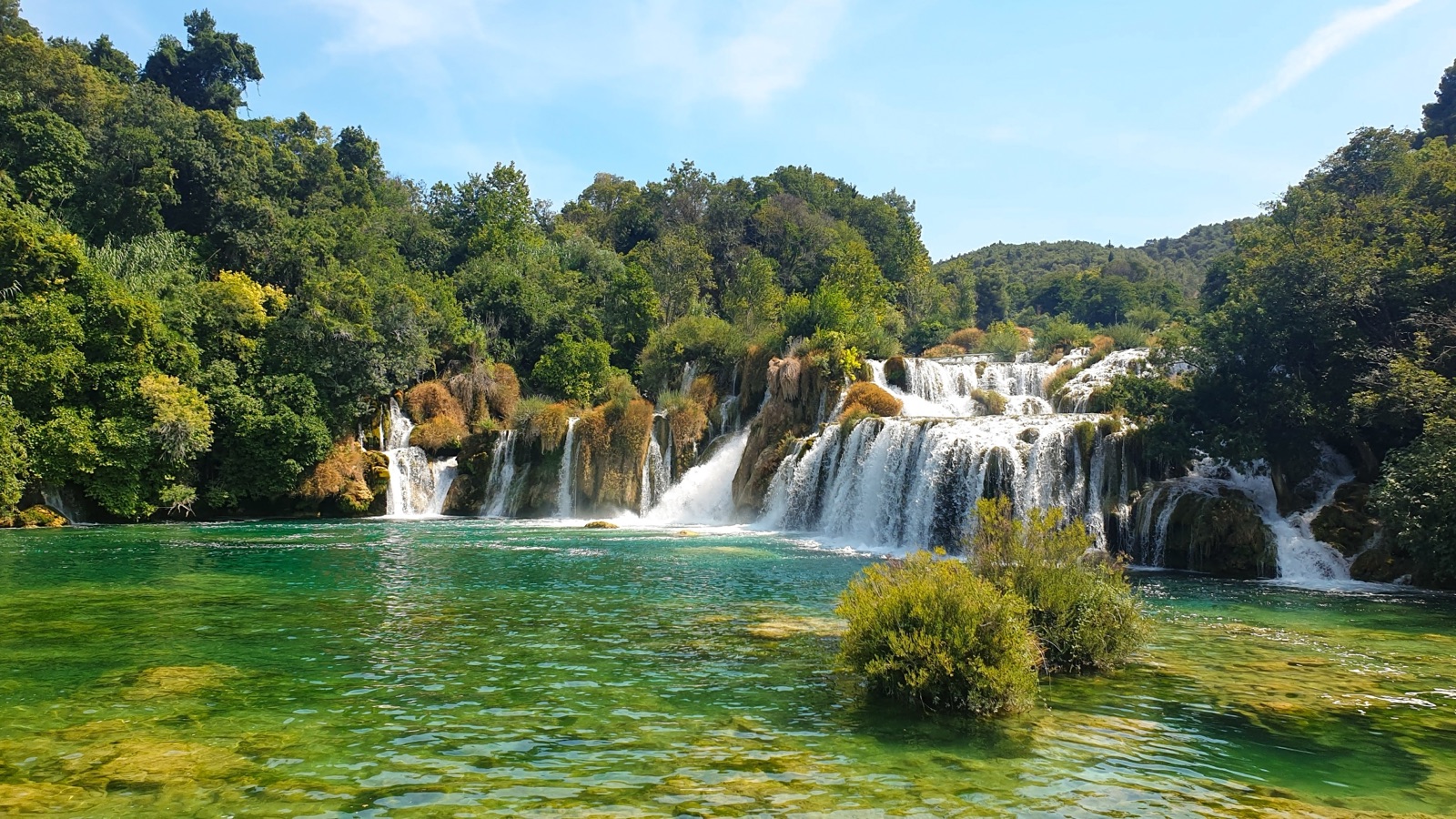
Skradinski buk is the seventh and last barrier, 49 km from the source and 13 km below Roški slap. The combined waters of the Krka and its main tributary, the Čikola, run over seventeen steps spread along 800 m, between 200 and 400 m wide, with a total height difference of 45.7 m. The park calls it the longest tufa barrier in Europe.
The upper part is a maze of small lakes, streams and islets; the lower part has high barriers that keep growing into new ridges, caves and overhangs, with mosses building curtains on the vertical faces. The barrier also shaped the river above it, backing the water up into a lake-like section 13 km long and drowning the last three kilometres of the Čikola. At the confluence sits Kalički busen, itself a tufa barrier 700 m long and just 10 m wide, which the boats to Visovac pass.
The watermills and washing posts around the falls have been restored, and the little church of St Nicholas is, according to the park, built entirely of tufa. A 1,900 m circular trail leads around the falls; our guide to tickets and trails covers the route and the rules. Swimming at Skradinski buk is not allowed.
Roški slap and the Necklaces
Roški slap, the sixth fall, lies 35.5 km from the source and takes its name from the hillfort of Rog. The park’s waterfall page describes a barrier 25.5 m high and 650 m long; its visitor page describes a main waterfall 22.5 m high among countless backwaters, cascades and tufa islands.
The barrier opens with a run of small cascades that local people named the Necklaces. The tallest fall, at the end, spreads like a funnel into Visovac Lake. A road has crossed the river here since Roman times, restored watermills line the left bank, and three restaurants are still owned by the millers’ families. A circular trail of 1,360 m crosses the Necklaces, and 517 wooden steps climb to the Oziđana pećina cave, where the brochure records human presence from 6000 to 1500 BC.
The brochure calls Roški slap the second most visited waterfall on the Krka. It is quieter than Skradinski buk; our guide to Krka boat trips compares the ways to get there by water.
Miljacka slap, where the Zrmanja joins underground
Upstream, past a long narrow canyon, lies a cluster of five falls. The lowest, Miljacka slap, is 21.5 km from the source, 23.8 m tall and 50 to 60 m wide, built of three large tufa steps and many small ones.
Its real oddity is invisible. Here water from another river, the Zrmanja, joins the Krka through the Miljacka spring, a direct link the park calls a unique hydrogeological phenomenon. Nearby, Miljacka II, the largest cave in the park, shelters the olm and long-fingered bats; the brochure describes the largest colony of that bat in Europe. Below the falls stands the Miljacka power plant, which the park says was the most powerful in Europe up to 1910. The waterfall itself is not suitable for visits.
Rošnjak, the Altar
A kilometre higher, 20.5 km from the source, Rošnjak is the river’s most modest fall: 8.4 m tall and 40 m wide, a single barrier that local people called the Altar. It hides in a canyon two hundred metres deep, and it is the only Krka waterfall where no mills were ever built, because nobody could reach it. It can only be seen from a distance.
Manojlovac: the tallest
At 19.5 km from the source is the fall the park calls the highest and most impressive on the Krka. Manojlovac is 59.6 m high, 500 m long and 80 to 100 m wide, a series of tufa barriers. The last and tallest, 32.2 m high, stands where the river swings sharply from north-west to south-east. Long moss beards hang from it, and the canyon walls shelter maidenhair fern, a rare relic of the Tertiary period.
There is a catch. In the warm part of the year little water flows over Manojlovac, because it is taken for the reservoir of the Miljacka power plant, so it is at its best in the wetter months.
Emperor Franz Joseph I admired it in 1875, and an inscription carved into the rock at the viewpoint records the visit. The brochure places the falls a few hundred metres from the Burnum archaeological site on the Knin to Kistanje road, with a car park and a 360 m trail to the viewpoint. In October 2026 the park’s homepage reported Burnum closed for conservation work, so check before you drive out.
Brljan and Bilušića buk: the upper falls
Brljan, 19 km from the source, is 15.5 m high, 300 m long and 180 m wide. People have altered it more than any other fall: a miner’s road was built across it in 1936, and a dam built early in the twentieth century for the Miljacka plant changed it most. The park’s viewpoint page says the fall is now dry in the warm part of the year, below a lake 400 m wide and 1,300 m long. The viewpoint sits at the top of the serpentine road on the right bank, close to Burnum, the Roman camp built in the first century AD to guard the river crossing.
Bilušića buk is the first fall of all, 16 km from the source: 22.4 m high, 300 m long and around 100 m wide. Unlike Brljan and Manojlovac it runs at full power all year, the whole river pouring over just two tufa steps. It lies 9 km downstream of Knin, reached by a 300 m trail to a viewpoint.
Why the falls change with the seasons
A tufa waterfall is only as good as the water running over it, and the Krka’s flow swings widely. The basin receives about 1,250 mm of rain a year, most of it in winter, while summers are very dry; a third of the year’s rain falls between October and December.
The park’s figures:
- River level: highest in November and March, lowest in August.
- Average flow: 12 m³/s at the source and 55 m³/s at Skradinski buk.
- The record: 481 m³/s on 24 December 1982.
On the ground that means:
- Late summer is the low point. Brljan runs dry and Manojlovac thins out, and the park notes that visitor numbers are highest.
- Winter, in the park’s words, is when the abundance of water is at the forefront and the forms of the tufa are best seen.
- Spring and autumn combine good water with comfortable temperatures. At Šibenik the mean is about 7 °C in January and 25 °C in July.
If seeing the falls at full strength matters most, aim for spring or late autumn, and check the boat and bus timetables for your dates, as several services stop over the winter.
Waterfalls that lit a city
On 28 August 1895 the Krka power plant at Skradinski buk started up, two days after the first plant on the Niagara. An 11 km power line and a lighting network were built with it, which the park calls the first complete electrical system in Croatia, and it was among the first plants anywhere to supply alternating current to light a city, Šibenik.
Four plants were built between 1895 and 1911: Krka and Jaruga II (1904) at Skradinski buk, Miljacka (1907) and Roški slap, which the park dates to 1910 on one page and 1911 on another. Three still produce electricity; the original Krka plant survives as protected ruins. The price of that power shows upstream, in the dry summer face of Brljan and the thin flow over Manojlovac.
Protecting the tufa
The park stresses that tufa is very sensitive to pollution and to any rise in organic matter. It was once quarried as building stone; since the park was declared it has been strictly protected. One survivor sits in Šibenik: a piece of Krka tufa placed in a fountain in front of the church of Gospa van Grada kept growing, and is now several times its original size.
For visitors the rules are short:
- No swimming at Skradinski buk. Swimming is allowed only in designated areas at Roški slap, Stinice and Pisak, from 1 June to 30 September, depending on weather and water level.
- No jumping off the falls or bridges, and no canoes or kayaks.
- Stay on the trails equipped for visitors.
Seeing the falls in a day
The one-day ticket covers a single visit to all the land localities on the same day, so with a car you can see most of the falls in one long day. The park’s boats sail in stages because the barriers block the river: Skradin to Skradinski buk, then on to Visovac and Roški slap.
A sensible order from the coast:
- Skradinski buk first, while it is quiet; our guide to getting to Krka explains the Lozovac and Skradin entrances.
- Roški slap by road or park boat, with the Necklaces trail.
- Manojlovac and Brljan from their viewpoints near Burnum, if the season is right.
- Bilušića buk last, near Knin, for the fall that runs full all year.
Without a car, the island monastery of Visovac sits on the boat route between Skradinski buk and Roški slap, and our comparison of Krka and Plitvice sets these falls against Croatia’s other tufa park.
Frequently asked questions
How many waterfalls are there in Krka National Park?
Seven: Bilušića buk, Brljan, Manojlovac, Rošnjak, Miljacka slap, Roški slap and Skradinski buk, all tufa barriers built by the river itself. Most visitors see only Skradinski buk and Roški slap.
Which is the biggest waterfall at Krka?
Manojlovac is the tallest, at 59.6 m. Skradinski buk is the longest: seventeen steps along 800 m with a total drop of 45.7 m, which the park calls the longest tufa barrier in Europe.
Can you swim at the Krka waterfalls?
Not at Skradinski buk. Swimming is allowed only in designated areas at Roški slap, Stinice and Pisak, from 1 June to 30 September, depending on the weather and water level. Check the current rules before you go.
When are the Krka waterfalls at their fullest?
The park records the highest river levels in November and March and the lowest in August. Brljan runs dry and Manojlovac thins out in the warm months, while Bilušića buk flows all year.
Is tufa the same as travertine?
Yes. The park uses both names for calcium carbonate deposited from river water onto mosses, algae and other surfaces. It is soft and porous, which is why the falls keep changing shape as they grow.