Reference
Krka National Park Map Explained: Entrances, Waterfalls, Trails and Boat Routes
Open any map of Krka National Park and the first surprise is its shape. This is not a block of land around a waterfall but a thin ribbon that follows a river. The park’s brochure describes a narrow belt around virtually the entire course of the Krka and the lower course of its tributary, the Čikola, with some localities tens of kilometres apart and separated by natural barriers. The river itself runs about 72.5 km from a spring near Knin to the sea at Šibenik, and the park covers 109 km² of it.
That shape explains most of the planning. Skradinski buk sits near the bottom of the map; Roški slap and Visovac are in the middle; the tallest waterfall, the Roman camp at Burnum and the falls near Knin are at the top. One ticket covers them all, but only some are linked by boat. Below: what sits where, which entrance reaches what, how far apart the points are, and where the roads, boats and trails run.
The park on one page
- The river: about 72.5 km long with a total drop of 224 m over seven tufa waterfalls, by the park’s own figures.
- The park: 109 km² of the river’s course and the lower Čikola, in Šibenik-Knin County.
- The entrances: four on the park’s website; ten points of entry in its brochure.
- On foot: 22 educational trails totalling 47 km; the brochure counts 5 lookout points, the website lists four along the roads.
- By bike: twelve marked routes covering 388 km.
- By car: every locality except Visovac Island.
From the spring at Knin to the sea at Šibenik
The top of the map is Knin. The park’s geology pages put the source of the Krka in a cave at the foot of the Krševac hill, 3.5 km north-east of the town. The main spring lies below the 22 m Topoljski buk waterfall, at 224 m above sea level, and it has a quirk: you can only see it in summer. The waterfall above it belongs to the Krčić, a stream 10.5 km long that rises at the foot of Dinara, west of Kijevo, and dries up in the warm months. In winter its water pours straight over the spring and hides it.
The park calls the Krčić the Krka’s first tributary and, in the morphogenetic sense, its true source. Its own brochure lists the spring among the sights around the park rather than inside it, under Knin, so treat it as an extra stop at the head of the river.
From there the river runs south. The park counts 49 km of freshwater course, down to Skradinski buk, and says the influence of the sea is felt on the remaining 23.5 km. That lower part is a drowned estuary, which our article on the Krka waterfalls explains, ending at the fortress of St Nicholas at the mouth of the channel into Šibenik. The town of Skradin sits at the head of the estuary; our Skradin guide explains why the town itself lies outside the park boundary.
The lower, middle and upper course
The park’s brochure divides the river into a lower, middle and upper course, with a map for each. It is the most useful way to read the map, because each stretch is visited in a different way.
| Stretch | What is there | Ways in | How you move |
|---|---|---|---|
| Lower course | Skradinski buk, the Čikola confluence and the Torak spring | Lozovac, Skradin, Skradin Bridge | Park bus or boat to the falls, then on foot |
| Middle course | Visovac, Roški slap, Oziđana pećina, Visovac House Kuželj | Stinice, Remetić, Roški slap, Laškovica, Bogatić Miljevački | Car, shuttle bus, boat, long trails |
| Upper course | Krka monastery, Trošenj and Nečven, Manojlovac, Brljan, Burnum, the Krka Eco Campus, Krka – well of life, Bilušića buk | Burnum, Puljane, Kistanje, roadside car parks | Car, short trails to viewpoints |
The lower course: Skradinski buk and the Čikola
The bottom of the map is the part most visitors see: Skradinski buk, the last and longest of the seven barriers, reached down from Lozovac or up the canyon from Skradin. Our guides to getting to Krka and to tickets, hours and trails cover both approaches and the 1,900 m circuit in detail.
What the map shows beyond the falls is easy to miss. Above Skradinski buk the river backs up into a lake-like stretch about 13 km long that also drowns the lower Čikola, and the two rivers meet around Kalički busen, a tufa barrier in the middle of the confluence. The best view of it is from the Krnići Gornji viewpoint: from Šibenik, instead of turning for Lozovac, carry on towards Pakovo Selo and look for it on the left. Further up the Čikola, the Goriš – Torak trail, 2,950 m, leads to the Torak viewpoint and down to the lake-like Torak spring, which the park’s shortest boat excursion also visits.
The middle course: Visovac, Roški slap and the canyon between
The middle of the map is a long, calm lake with an island in it, closed at its upper end by a narrow gorge and a second waterfall.
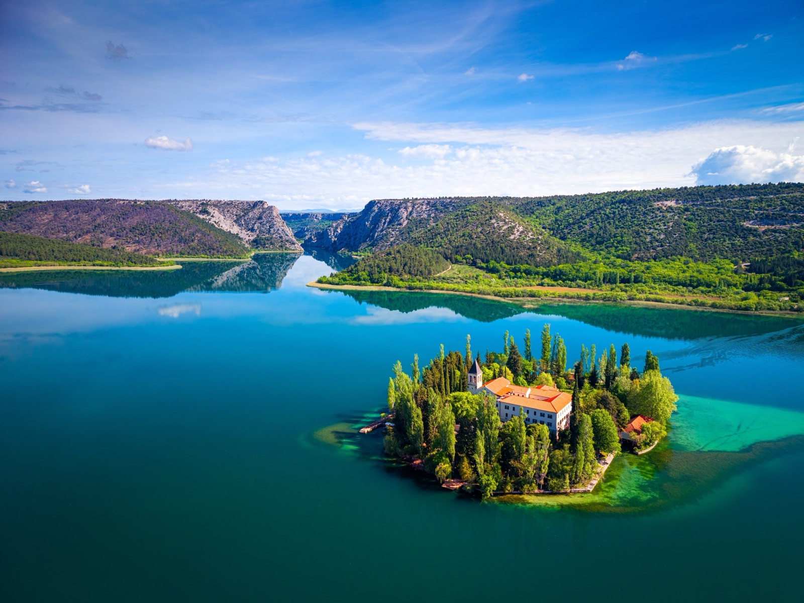
- Visovac Island and its Franciscan monastery sit in Visovac Lake. Boats cross to it in five minutes from Stinice on the left bank or Remetić on the right; our article on Visovac monastery covers the island.
- Među gredama, the narrow strait between the lake and Roški slap, is where the excursion boats squeeze through.
- Roški slap, the park’s second most visited waterfall, with the Necklaces cascades, watermills and a road bridge across the river; our article on Roški slap covers it in full.
- Oziđana pećina, a prehistoric cave at the top of the canyon above Roški slap, up 517 wooden steps.
On foot, the spine of this stretch is the Stinice – Roški slap – Oziđana pećina trail, 8,500 m one way, which links the lakeshore, the falls and the cave on the left bank. The Visovac House Kuželj, a forest visitor centre, stands at its Stinice end.
The upper course: the Krka above Roški slap
Above Roški slap the river climbs back into a deep canyon, and the map fills with names that few day visitors reach. Boats from Roški slap head upstream through the Brzica straits towards Carigradska draga, where the Orthodox monastery of the Holy Archangel, the Krka monastery, stands by the river. Beyond it are the medieval fortresses of Trošenj and Nečven, facing each other across the canyon and seen from the boat.
The top of the map belongs to the road. Burnum, at Ivoševci on the right bank, has the remains of the only preserved Roman military amphitheatre in Croatia and the arches of the camp’s command building; in October 2026 the park’s homepage reported it closed for conservation work. Manojlovac, the tallest waterfall, is a few hundred metres away on the Knin – Kistanje road. Across Brljan Lake on the left bank is the Krka Eco Campus in Puljane, with the Burnum archaeological collection, and in Kistanje, at the western entrance, the Krka – well of life interpretation centre. Bilušića buk, the first waterfall, is 9 km downstream of Knin.
Four entrances, or ten?
The two sources the park publishes count its entrances differently, and both are right in their own way.
The website lists four entrances: Lozovac, Skradin, Roški slap / Laškovica and Burnum / Puljane. These are the main ways into each stretch. The brochure lists ten: Lozovac, Skradin and Skradin bridge, which are the three ways into Skradinski buk, plus Stinice, Roški slap, Oziđana pećina cave, Laškovica, Burnum, Manojlovac and the Krka Eco Campus in Puljane. The longer list simply adds the smaller points where visitors enter particular sites.
| Entrance | What it reaches |
|---|---|
| Lozovac | Skradinski buk by park bus, or the 875 m trail |
| Skradin | Skradinski buk by park boat |
| Skradin Bridge | Skradinski buk on the 3,400 m walking and cycling trail |
| Stinice | Visovac by a five-minute boat, which also crosses from Remetić on the right bank |
| Roški slap and Laškovica | Roški slap, the boats to Visovac and the fortresses, the summer shuttle |
| Oziđana pećina | The cave, from the car park at Bogatić Miljevački |
| Burnum, Manojlovac, Puljane | The upper course |
One ticket covers a single visit to every land locality on the same day, so the entrances matter mainly for the order of the day, not the price.
The park’s own GPS points
The park warns that satellite navigation can lead visitors into fields instead of to an entrance, and asks them to follow the brown tourist signs. Its printed map gives coordinates for the main receptions, which are worth entering before you set off.
| Point on the park map | Latitude | Longitude |
|---|---|---|
| Lozovac (reception) | N 43°47’47.21” | E 15°58’04.87” |
| Skradin | N 43°49’01.32” | E 15°55’24.24” |
| Remetić | N 43°51’35.73” | E 15°58’05.61” |
| Stinice | N 43°51’45.26” | E 15°58’45.03” |
| Roški slap (reception) | N 43°54’15.42” | E 15°58’39.16” |
| Kistanje (reception) | N 43°57’43.82” | E 15°59’20.87” |
| Burnum (reception) | N 44°01’01.35” | E 16°00’55.31” |
| Puljane Eco Campus | N 44°00’05.93” | E 16°01’24.86” |
Distances between the main points
Because the park is a ribbon, the distances between its own sites matter as much as the drive from the coast. The brochure prints a table of road distances in kilometres between the main points.
| From | Visovac | Roški slap | Krka – well of life | Burnum | Krka Eco Campus |
|---|---|---|---|---|---|
| Lozovac | 27 | 33 | 39 | 47 | 42 |
| Skradin | 10 | 17 | 31 | 42 | 47 |
| Laškovica | 9 | 2 | 10 | 18 | 23 |
| Drniš | 15 | 18 | 30 | 27 | 23 |
| Knin | 52 | 42 | 32 | 21 | 21 |
The same table puts Lozovac and Skradin just 5 km apart. Treat the figures as a guide: the brochure’s page on the hostel at the Eco Campus gives 46 km from Lozovac and 43 km from Skradin, not the 42 km and 47 km in the table.
From the coast, the brochure’s other table adds the middle and upper course. Šibenik is 38 km from Roški slap, 54 km from the Krka Eco Campus and 59 km from Burnum; Split is 105 km from Roški slap but only 87 km from the Eco Campus and 92 km from Burnum; Zadar is 81 km, 95 km and 90 km. The distances to Lozovac and Skradin are in our guide to getting to Krka.
Boat routes on the map
The boat lines on the park’s maps are not one route but several short ones, because no boat can pass a waterfall. The brochure’s maps mark them stage by stage:
- Lower course: the transfer Skradin – Skradinski buk – Skradin, included in the ticket in season, and three excursions from Skradinski buk: to Visovac and back, to Visovac and Roški slap and back, and to the Torak spring on the Čikola.
- Middle course: the short crossing Stinice – Visovac – Remetić, and the excursion from Roški slap to Visovac and back.
- Upper course: the excursion from Roški slap towards the Trošenj and Nečven fortresses, with departures until 15:00.
The boats on the Roški slap – Visovac route include two electric catamarans the park bought for that stretch, each carrying fifty passengers. Times, prices and the booking rules are in our guide to Krka boat trips.
Roads and river crossings
The road network explains why some sites that look close on the map are a long drive apart. The river sits in a canyon, and the park’s brochure says the road bridge at Roški slap is one of only four crossings over it. The bridge is not under the park’s control and is narrow, so the park sends walkers over the footbridge across the Necklaces instead.
The main roads to know:
- The A1 motorway, with the Šibenik exit for Lozovac and the Skradin exit for Skradin.
- The road from Šibenik towards Drniš, which the park tells drivers to follow before picking up the brown signs; Roški slap is reached via the Šibenik – Pakovo Selo or Šibenik – Skradin roads.
- The county road Drniš – Kistanje, which crosses the river at Roški slap.
- The Knin – Kistanje road, for Manojlovac and Burnum.
- County road Ž6055, for the Krka Eco Campus, which leaves it just above the Brljan waterfall; it joins state road D33 on the left bank and D59 on the right.
Inside the park the speed limit is 50 km/h. Next to its list of GPS points, the park’s map names four routes: Šibenik – Skradinski buk, Šibenik – Visovac – Roški slap, Šibenik – Burnum, and Skradin – Visovac – Roški slap – Burnum.
Trails, bike routes and viewpoints
The trail lines are the park’s educational trails, 22 of them, 47 km in all. Most are short there-and-back walks to a viewpoint; a few are real hikes.
- Lower course: Skradin Bridge – Skradinski buk 3,400 m, Lozovac – Skradinski buk 875 m, the Skradinski buk circuit 1,900 m, and Goriš – Torak 2,950 m.
- Middle course: the Roški slap circuit 1,360 m, Niz ploču 1,500 m, Laškovica – Žižići – Roški slap 3,300 m, Rogovo 2,300 m, Brnjica – Čikola riverbed 1,450 m, Ključica 1,600 m, Bačići 1,800 m, Vukovića podi 350 m, and the long Stinice trail.
- Upper course: the Krka monastery 2,100 m, Pištavac 850 m, Trošenj – Pištavac 5,700 m, Perice 1,800 m, Manojlovac 360 m, Rimski put 630 m, Brljan – Manojlovac 910 m, Bilušića buk 300 m and Marasovine 2,700 m.
The bike routes start from three places, the park office in Skradin, the Laškovica visitor centre and the Krka Eco Campus in Puljane, where you can pick up a cycling map.
For viewpoints, the park’s website names four along the roads: Krnići Gornji over the Čikola confluence, Čikola, Visovac, with the statue of King Petar Svačić above the island, and Brljan, at the top of the serpentine road on the right bank. Many trails also lead to their own lookouts, such as the imperial viewpoint at Skradinski buk, the viewpoint above Manojlovac and the Rogovo viewpoint over Među gredama.
How to read the park’s own map
The park’s maps and brochures page offers PDF maps of the whole park, of Skradinski buk and of Roški slap, alongside the brochures. On the whole-park map the legend marks receptions, boat excursions, educational trails, bicycle trails, fortress ruins, churches, caves, archaeological sites and collections, the motorway and the park area. The cave symbol near Roški slap is Oziđana pećina, the only cave in the park open to visitors.
A few tips for using it:
- Read it from bottom to top. The river flows south, so downstream is down the page: Skradinski buk near the bottom, Knin at the top.
- Check which bank you are on. Many sites face each other across a canyon with no bridge between them, such as Stinice and Remetić, or the fortresses of Nečven and Trošenj, once joined by a bridge that no longer exists.
- Use the trail downloads. Each trail page on the park’s site offers its own map as PDF, GPX and KML/KMZ files.
- Look for the tactile maps. The park has a tactile map of Skradinski buk at the imperial lookout point by the falls, with raised relief for visitors who are blind or partially sighted.
Planning a day with the map
With one ticket and each locality counted once, the map turns into a simple question of order. Three patterns work:
- The lower course only: Skradinski buk from Lozovac or Skradin, in and out the same way. Half a day.
- Lower and middle course by car: Skradinski buk in the morning, then the 33 km from Lozovac to Roški slap, with Visovac from Stinice or Remetić on the way if time allows.
- Middle and upper course: Roški slap and Oziđana pećina, then north to Manojlovac and the Brljan viewpoint, with Burnum if it has reopened. Check before you go.
Without a car, the boats join the lower and middle course but not the upper; the 4-hour excursion from Skradinski buk to Roški slap is the way to see the middle of the map in a day. The tours page lists the tours and the all-sites ticket.
Frequently asked questions
Where can I get a map of Krka National Park?
The park’s maps and brochures page offers PDF maps of the whole park, Skradinski buk and Roški slap, and each trail page has its own map to download as PDF, GPX or KML.
How many entrances does Krka National Park have?
The park’s website lists four: Lozovac, Skradin, Roški slap / Laškovica and Burnum / Puljane. Its brochure lists ten points of entry, adding Skradin Bridge, Stinice, Oziđana pećina, Laškovica, Manojlovac and the Krka Eco Campus.
How far is Roški slap from Skradinski buk?
By the park’s table, Roški slap is 33 km by road from Lozovac and 17 km from Skradin. By water it is a 4-hour excursion from Skradinski buk, with a stop on Visovac.
Where does the Krka River start?
In a cave at the foot of the Krševac hill, 3.5 km north-east of Knin, below the Topoljski buk waterfall of the Krčić. The spring is only visible in summer, when the Krčić runs dry.