Krka National Park Hiking and Cycling: Every Trail and Bike Route Explained
Krka National Park has 47 km of marked hiking trails and 388 km of bicycle routes, and almost all of the walking that visitors do happens on two of them: the 1,900 m circuit at Skradinski buk and the 1,360 m loop over the Necklaces at Roški slap. Both are short and mostly easy. Beyond them the park runs trails from a 300 m stroll to a viewpoint up to the 8,500 m forest trail from Stinice to Oziđana pećina cave, and twelve marked, circular bike routes of 8.6 km to 95.1 km. This guide goes course by course, from Skradinski buk upstream to the falls near Knin, with each trail’s length, surface and difficulty from the park’s own pages, and then covers the bike routes and the rules.
The short answer
- Easiest walks: the Skradinski buk circuit, the Roški slap trail, Manojlovac and Bilušića buk.
- Best half-day hike: Skradin Bridge to Skradinski buk, 3,400 m each way, or Laškovica to Roški slap, 3,300 m.
- Hardest: the Stinice – Roški slap – Oziđana pećina trail, 8,500 m with 517 stairs up to the cave.
- Best view for the effort: Rogovo, over the Među gredama canyon and Visovac Lake.
- Easiest bike ride: Trek 2 from Puljane, 9.8 km with 61 m of climbing.
- Bike to the falls: Trek 4 from Skradin to Skradinski buk and back, 8.6 km.
Before you go
The park’s general advice covers every trail: good footwear, layered clothing and enough water. Trails mix wooden boardwalks and bridges, gravel, earth and paving. The park describes the trails of the middle and upper courses as varying in length and character, needing an average to good level of fitness.
Rules for walkers, from the park rules:
- Stay on the marked trails. Walking outside marked trails and visitor areas is not allowed, and neither is moving along the tufa barriers outside the trails.
- No picking plants, no breaking or damaging tufa, no touching or removing old dry-stone walls and monuments.
- Dogs on a lead at all times, and not on Visovac Island.
- No drones.
- No fires and no camping.
- Keep the noise down. The park asks visitors to respect its natural silence.
A ticket is needed: the park says every visitor must have a valid ticket for each day spent in the park, walkers and cyclists included. The all-sites ticket covers every land locality on the same day; see the tickets and trails guide for prices.
The lower course: Skradinski buk
| Trail | Length | Surface and difficulty |
|---|---|---|
| Skradinski buk circuit | 1,900 m | Wooden bridges, stairs, one-way loop; easy |
| Lozovac – Skradinski buk | 875 m | Gravel, steep descent |
| Skradin Bridge – Skradinski buk | 3,400 m | Gravel and earth, walkers and cyclists |
| Goriš (Torak) | 2,950 m | Gravel and earth, two branches |
| Brnjica – Čikola riverbed | 1,450 m | Off the Šibenik – Drniš road |
| Ključica | 1,600 m | From Ključ on the Miljevci plateau |
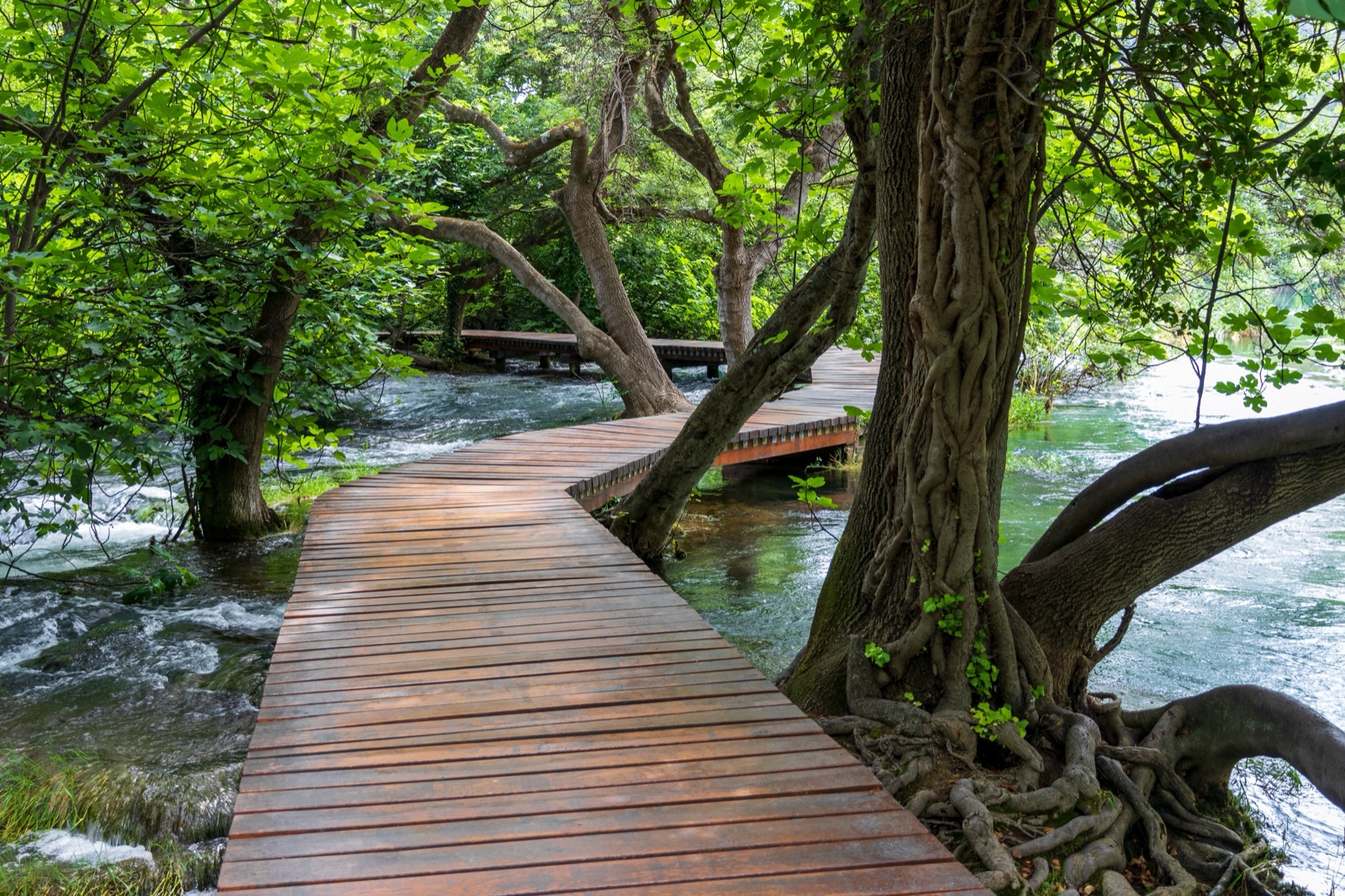
The Skradinski buk circuit. The park’s best-known walk is a 1,900 m one-way loop over wooden bridges, up stairs and through the ethno village. It takes about an hour and a half. You arrive on the 875 m trail from Lozovac, by park bus, by car in winter, or by boat or on foot from Skradin. The combined waters of the Krka and Čikola spill over the 17 steps of Skradinski buk, spread over 800 metres, and the wooden bridge is the closest you can get to the falls. There are free toilets at Lozovac and by the ethno village.
Lozovac – Skradinski buk. A short, steep gravel trail, 875 m, from the main reception at Lozovac down to the river, with a view of the moment the Čikola joins the Krka. Free parking at Lozovac all day. Come back up the same way, or by bus in season.
Skradin Bridge – Skradinski buk. The longest of the three trails to the falls, 3,400 m, from the reception at Skradin Bridge up the right bank of the canyon. It starts with a long, gentle descent to the river and has speed bumps near the end, because it is also a cycling trail and fire-control road. On the way you pass Macelinuša, the largest island on the Krka. Parking at the bridge is free but limited to about 10 cars. You can come back by boat to Skradin, but not with a bicycle.
Goriš and Torak. Off the Šibenik – Drniš road, follow the signs for Goriš. The trail splits: a 1,500 m gravel and earth branch to the Torak viewpoint, and a 1,450 m gravel branch down to Torak itself. Torak is a lake-like spring 150 m across and about 30 m deep, with the spring at the bottom, at the confluence of the Krka and Čikola. Beside it the islet of Kalički Busen is about 700 m long and just 10 m wide. The brochure warns that the part down to the spring is steep and needs time and fitness. Park in the open along the road through the village. The same spot is reached on the park’s 45-minute Čikola boat excursion from Skradinski buk.
Brnjica and Ključica. Two shorter trails on the Čikola side: Brnjica to the Čikola riverbed, 1,450 m, and Ključica, 1,600 m, near the medieval fortress of the same name.
The middle course: Roški slap, Visovac and the cave
| Trail | Length | Surface and difficulty |
|---|---|---|
| Roški slap (Necklaces) | 1,360 m | Circular, completely flat |
| Laškovica – Žižići – Roški slap | 3,300 m | Gravel, one long ascent |
| Niz ploču | 1,500 m | Flat, then down a rock face; dry weather only |
| Stinice – Roški slap – Oziđana pećina | 8,500 m | Advanced; 517 stairs to the cave |
| Rogovo | 2,300 m | Flat gravel, steep final passage |
| Vukovića podi | 350 m | Short, from Dubravice |
The Roški slap trail. A completely flat 1,360 m circuit over the Necklaces, the chain of cascades above the main fall, with gravel sections, a wooden bridge and the road bridge. It passes the watermills, where the old trades are demonstrated, and the park suggests them as the place to rest and have a snack. A bridge with 22 stone arches, left from the Roman period, crosses the river here. Brown trout and chub swim in the river, and the rare mammals include wildcats and otters.
Laškovica – Žižići – Roški slap. A 3,300 m gravel trail with one long ascent, from the car park in front of the Laškovica visitor centre or the one near the Roški slap reception. It gives the best view of the Roški slap hydroelectric plant, built in 1909/1910. It is not a loop, so plan your return; in summer the free shuttle between Laškovica and Roški slap helps.
Niz ploču (Down the cliff). An old villagers’ path, 1,500 m, from Bogatići Miljevački down to the Necklaces. The first half to a viewpoint is flat gravel; then it descends through the hillside and down the rock face, with a protective railing. The park says it needs good non-slip footwear and is recommended only in dry weather. High above Roški slap, at 156 m above sea level, is a small cave called Suza na Ploči, the Tear of the Slab. Twenty-two bird species live on the cliffs of Roški slap and the Među gredama canyon, including the nesting short-toed snake eagle.
Stinice – Roški slap – Oziđana pećina. The park’s longest and most demanding trail: 8,500 m with earth and gravel sections, wooden bridges and stairs, many climbs and descents, and “the highly strenuous ascent up the 517 stairs” to Oziđana pećina cave. You can join or leave it at Stinice, Brištane Gornje, Roški slap or Oziđana pećina (Bogatići Miljevački). It is not circular, so plan your return: from June to September a bus runs Laškovica – Roški slap – Bogatići Miljevački – Stinice.
Oziđana pećina cave. The cave can be reached from Roški slap up the 517 wooden steps, or more gently from the car park at Bogatić Miljevački, by a 500 m trail and 99 steps. Archaeologists have recorded continuous human presence here from 6000 to 1500 BC. It is open from April to the end of September, and in winter only by appointment.
Rogovo. From the Rupe – Laškovica road, follow the signs for the Rogovo viewpoint. The 2,300 m trail is partly paved and earthen, then flat gravel, and the viewpoint is reached by a narrow, steep earth passage; return the same way. It looks over the Među gredama canyon where it opens into Visovac Lake, the site of the early Croatian fortress of Rogovo. The canyon was chosen as a location for the Winnetou films.
Vukovića podi. A 350 m walk from Dubravice, on the right bank.
The upper course: Manojlovac, Burnum and the first falls
| Trail | Length | Start |
|---|---|---|
| Manojlovac | 360 m | Parking above the Brljan waterfall |
| Brljan – Manojlovac | 910 m | Same parking area |
| Roman road (Rimski put) | 630 m | Car park reached from Ivoševci |
| Bilušića buk | 300 m | Burze, on the Knin – Kistanje road |
| Perice | 1,800 m | Nečven, on the left bank |
| Trošenj – Pištavac | 5,700 m | Kistanje, on the right bank |
| Marasovine | 2,700 m | Marasovine, on the Oklaj – Ljubotić – Knin road |
Manojlovac. The short trail to see the Krka’s tallest waterfall, 360 m: gravel, then earth to the imperial viewpoint, on two levels separated by stairs, with mild climbs and descents. Manojlovac is about 500 m long and 80 to 100 m wide, a series of barriers with a total height of 59.6 metres. Emperor Franz Joseph I visited in 1875, and an inscription at the viewpoint records it. Park at the bend of the Oklaj – Kistanje road above the Brljan waterfall. From the same spot, the 910 m Brljan – Manojlovac trail links the two falls.
Burnum and the Roman road. The Roman military camp of Burnum holds the only preserved Roman military amphitheatre in Croatia. The 630 m Roman road trail starts from the car park reached from Ivoševci, on the Kistanje – Knin road.
Bilušića buk. The first of the Krka’s falls, 9 km downstream of Knin, with a 300 m trail to a viewpoint from the hamlet of Burze.
Perice, Trošenj – Pištavac and Marasovine. Longer, quieter trails on the canyon’s edges: Perice from Nečven, 1,800 m; Trošenj – Pištavac from Kistanje, 5,700 m, towards the fortress of Trošenj; and Marasovine, 2,700 m. The fortresses of Trošenj and Nečven can also be seen from the park’s 2-hour boat excursion from Roški slap.
Krka Bike: the twelve marked routes
The park has twelve marked cycling routes: three mountain-bike (MTB), three road and six trekking routes for easier family rides. All are circular, so you mostly return without repeating the same way, and all start and finish at one of three points: the park office in Skradin, the Laškovica visitor centre or the Krka Eco Campus in Puljane. The park publishes route brochures, maps and GPS traces.
| Route | Start | Length | Climb | Difficulty |
|---|---|---|---|---|
| Trek 1 | Puljane | 11.4 km | 273 m | 1/4 |
| Trek 2 | Puljane | 9.8 km | 61 m | 1/4 |
| Trek 3 | Skradin | 21.1 km | 490 m | 1/4 |
| Trek 4 | Skradin | 8.6 km | 262 m | 1/4 |
| Trek 5 | Laškovica | 13.9 km | 114 m | 2/4 |
| Trek 6 | Laškovica | 24.5 km | 625 m | 1/4 |
| MTB1 | Skradin | 25.8 km | 680 m | 2/4 |
| MTB2 | Skradin | 21.8 km | 599 m | 3/4 |
| MTB3 | Laškovica | 34.4 km | 732 m | 3/4 |
| Road 1 | Skradin | 58.8 km | 1,156 m | – |
| Road 2 | Skradin | 95.1 km | 1,447 m | – |
| Road 3 | Laškovica | 63.1 km | 720 m | – |
Highlights by start point.
- From Skradin: Trek 4 is the ride to Skradinski buk and back, 8.6 km from Skradin along the river. Leave the bike at the marked spot by the reception and walk the circuit. Trek 3 heads for the Remetić viewpoint over Visovac. MTB2 takes in Rogovo and Roški slap.
- From Laškovica: Trek 6 loops via Roški slap and Oziđana pećina, 24.5 km with 625 m of climbing. Trek 5, 13.9 km with only 114 m of climbing, visits the Rogovo and Dračevica viewpoints.
- From Puljane: Trek 2 to the Nečven viewpoint is the flattest route in the network, and Trek 1 goes to Burnum.
Bike hire. The Krka Eco Campus in Puljane hires out electric bikes, but only with prior notice, with instructions and a list of recommended routes.
Rules for cyclists
- Bicycles are not allowed on the boat to Skradin, so ride back the way you came.
- Share the trail. On the Skradin Bridge trail you ride among walkers; give way and slow down.
- Croatian road rules apply: use bike paths where there are any, ride in single file in a group, and riders under 16 must wear a helmet on the road.
- Ride only open trails, respect closures and private land, and do not frighten livestock or wildlife.
- Leave no trace: stay on the existing trail and do not cut corners.
Which walk for which visitor
- First visit, short on time: the Skradinski buk circuit, then the Roški slap trail by car or on the boat excursion.
- A proper hike: Skradin Bridge to Skradinski buk and back by boat, or the Stinice – Roški slap – Oziđana pećina trail with the summer bus.
- Families with small children: the flat Roški slap loop and the mills, Manojlovac, Bilušića buk.
- Photographers: Rogovo, Manojlovac’s imperial viewpoint and Torak.
- Cyclists: Trek 4 for the falls, Trek 6 or MTB3 for a full day.
When to walk
Spring and autumn are the park’s own recommendation for the trails and bicycle routes, with comfortable temperatures. In summer, start early: the park opens at 8:00. Oziđana pećina cave opens from April to the end of September, and the middle-course bus runs from June to September. The best time to visit guide has hours month by month, and the parking guide lists every trailhead car park. For guided days or tickets, see the tours page.